Spacecraft
Spacecraft
Spacecraft
EARTH REMOTE SENSING SPACECRAFT
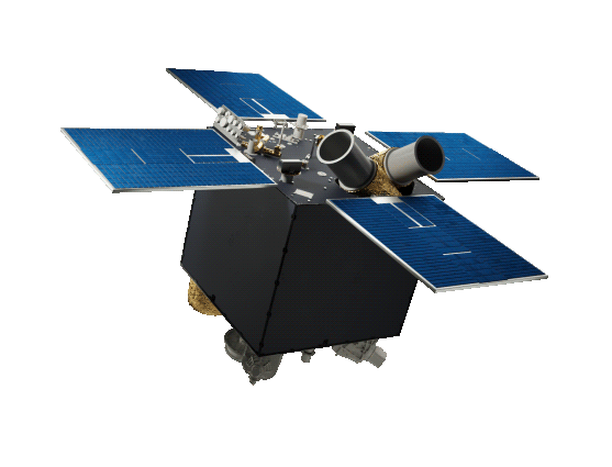
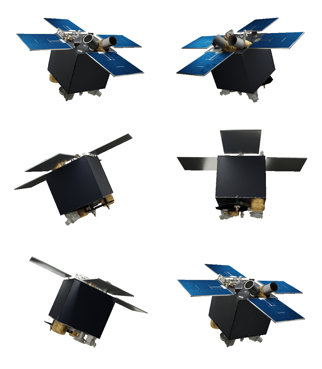
SICH-2-1
Sich-2-1
EARTH REMOTE SENSING SPACECRAFT
DESCRIPTION
SATELLITE BASIC SPECIFICATIONS
| Mass, kg: | |
| – total | 155 |
| – payload | 35.5 |
| Orbit: | |
| – type | SSO |
| – altitude, km | 500 to 600 |
| – inclination, deg | SSO±0.1 |
| – local mean time | 10 hours 00 minutes + 60 minutes |
| Attitude control: | |
| – type | 3-axis active |
| – sensors | Open-loop tracker, rate-measuring devices, 3 axis magnetometer |
| – actuators | Reaction wheels, magnetic actuators |
| Satellite rotation to aim imagers, deg | ±35 |
| Attitude control accuracy, deg, not worse than: | |
| – imaging | 0.2 |
| – standby | 5 |
| Active life, years | 3 |
PAYLOAD BASIC SPECIFICATIONS
| Multi-Band Earth Imager | |
| Spectral bands, μm: | |
| 0.51—0.59 (green) | |
| 0.61—0.68 (red) | |
| 0.80—0.89 (near IR) | |
| 0.51—0.90 (panchrom) | |
| Resolution at nadir, m | ~7.8 |
| Swath width at nadir, km | ~46.6 |
Sich-3-O
Sich-3-O
EARTH REMOTE SENSING SPACECRAFT
DESCRIPTION
The optical Earth observation satellite Sich-3-O will obtain super-resolution digital panchromatic and multispectral visible images of Earth surface.
The ammonia propulsion system in the satellite supports orbital correction maneuvers.
SATELLITE BASIC SPECIFICATIONS
| Mass, kg | ~290 |
| Orbit: | |
| ‒ type | Sun-synchronous |
| ‒ altitude, km | ~ 500 |
| Attitude control: | |
| ‒ type | 3-axis active |
| ‒ sensors | Open-loop tracker, rate-measuring devices, 3-axis magnetometer |
| ‒ actuators | Reaction wheels, Magnetic actuators |
| Satellite rotation to aim imagers, deg | ±45 |
| Active life, years | 7 |
PAYLOAD BASIC SPECIFICATIONS
| Spectral ranges: | |
| ‒ panchromatic | 1 |
| ‒ multispectral | 4 (R, G, B, NIR) |
| Resolution at nadir, m: | |
| ‒ panchromatic | 0.5 |
| ‒ multispectral | 2 |
| Swath size, km: | |
| ‒ strip imaging | 10×1600 |
| ‒ area imaging | 30×250 |
| ‒ spotlight imaging | 10×10 |
| ‒ stereo imaging | 10×250 |
Sich-3-R
Sich-3-R
EARTH REMOTE SENSING SPACECRAFT
DESCRIPTION
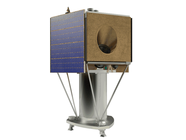
The Sich-3-R Earth radar observation satellite will obtain high-resolution radar images of Earth surface regardless of light conditions and weather.
The satellite payload is a two-band synthetic-aperture radar.
An ammonia propulsion system in the satellite supports orbital correction maneuvers.
SATELLITE BASIC SPECIFICATIONS
| Mass, kg | 1800 |
| Orbit: | |
| ‒ type | Sun-synchronous morning-evening orbit |
| ‒ altitude, km | 450 |
| Attitude control: | |
| ‒ type | 3-axis active |
| ‒ sensors | Open-loop tracker, rate-measuring devices, 3 axis magnetometer |
| ‒ actuators | Reaction wheels, magnetic actuators |
| Roll angles, deg | ± 60 |
| Attitude control accuracy, deg | 0.05 |
| Active life, years | 7 |
PAYLOAD BASIC SPECIFICATIONS
| Ground resolution, m: | |
| ‒ Х-band Spotlight | 0.5 |
| ‒ Х-band Stripmap | 0.75 |
| ‒ Two-band (Х/L) Stripmap | 2 / 5 |
| ‒ Two-band (Х/L) ScanSAR | 1.5 / 1.5 |
| ‒ L-band ScanSAR | 1.5 |
| Swath width, km: | |
| ‒ Х-band Spotlight | 2.5 × 2.5 |
| ‒ Х-band Stripmap | 7.5 |
| ‒ Two-band (Х/L) Stripmap | 15 |
| ‒ Two-band (Х/L) ScanSAR | 100 |
| ‒ L-band ScanSAR | 250 |
MS-VR
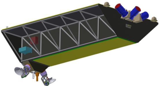
MS-VR
EARTH REMOTE SENSING SPACECRAFT
DESCRIPTION
SATELLITE BASIC SPECIFICATIONS
| Mass, kg: | |
| – total | ~50 |
| – payload | ~15 |
| Orbit: | |
| – type | Sun-synchronous |
| – altitude, km | ~500 |
| Off-track re-aiming capability, km | ±350 |
| Data radiolink rate, Mbps | 320 |
| Orbit correction capability | available |
| Active life, years | > 5 |
Payload Basic Specifications
| Spectral ranges: | |
| – panchromatic | 1 |
| – multispectral | 4 (R, G, B, NIR) |
| Resolution at nadir, m: | |
| – panchromatic | ~ 1 |
| – multispectral | ~ 1 |
| Swath size, km: | |
| – spotlight imaging | 7.5 × 7.5 |
| – strip imaging | 7.5 (width) |
| – area imaging | 40×40 |
| – stereo imaging | 20×40 |
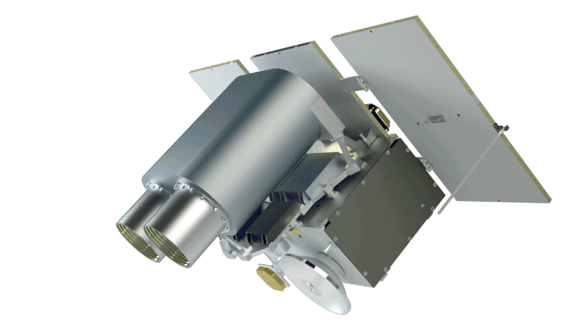
EARTH REMOTE SENSING SPACECRAFT
SICH-2-1
Sich-2-1

DESCRIPTION
SATELLITE BASIC SPECIFICATIONS
| Mass, kg: | |
| ‒ total | 155 |
| ‒ payload | 35.5 |
| Orbit: | |
| ‒ type | SSO |
| ‒ altitude, km | 500 to 600 |
| ‒ inclination, deg | SSO±0.1 |
| ‒ local mean time | 10 hours 00 minutes + 60 minutes |
| Attitude control: | |
| ‒ type | 3-axis active |
| ‒ sensors | Open-loop tracker, rate-measuring devices, 3 axis magnetometer |
| ‒ actuators | Reaction wheels, magnetic actuators |
| Satellite rotation to aim imagers, deg | ±35 |
| ‒ imaging | 0.2 |
| ‒ standby | 5 |
| Active life, years | 3 |
PAYLOAD BASIC SPECIFICATIONS
| Multi-Band Earth Imager | |
| Spectral bands, μm: | |
| 0.51—0.59 (green) | |
| 0.61—0.68 (red) | |
| 0.80—0.89 (near IR) | |
| 0.51—0.90 (panchrom) | |
| Resolution at nadir, m | ~7.8 |
| Swath width at nadir, km | ~46.6 |

Sich-3-O
Sich-3-O

DESCRIPTION
The optical Earth observation satellite Sich-3-O will obtain super-resolution digital panchromatic and multispectral visible images of Earth surface.
The ammonia propulsion system in the satellite supports orbital correction maneuvers.
SATELLITE BASIC SPECIFICATIONS
| Mass, kg | ~290 |
| Orbit: | |
| ‒ type | Sun-synchronous |
| ‒ altitude, km | ~ 500 |
| Attitude control: | |
| ‒ type | 3-axis active |
| ‒ sensors | Open-loop tracker, rate-measuring devices, 3-axis magnetometer |
| ‒ actuators | Reaction wheels, Magnetic actuators |
| Satellite rotation to aim imagers, deg | ±45 |
| Active life, years | 7 |
PAYLOAD BASIC SPECIFICATIONS
| Spectral ranges: | |
| ‒ panchromatic | 1 |
| ‒ multispectral | 4 (R, G, B, NIR) |
| Resolution at nadir, m: | |
| ‒ panchromatic | 0.5 |
| ‒ multispectral | 2 |
| Swath size, km: | |
| ‒ strip imaging | 10×1600 |
| ‒ area imaging | 30×250 |
| ‒ spotlight imaging | 10×10 |
| ‒ stereo imaging | 10×250 |
Sich-3-R
Sich-3-R

DESCRIPTION
The Sich-3-R Earth radar observation satellite will obtain high-resolution radar images of Earth surface regardless of light conditions and weather.
The satellite payload is a two-band synthetic-aperture radar.
An ammonia propulsion system in the satellite supports orbital correction maneuvers.
SATELLITE BASIC SPECIFICATIONS
| Mass, kg | 1800 |
| Orbit: | |
| ‒ type | Sun-synchronous morning-evening orbit |
| ‒ altitude, km | 450 |
| Attitude control: | |
| ‒ type | 3-axis active |
| ‒ sensors | Open-loop tracker, rate-measuring devices, 3 axis magnetometer |
| ‒ actuators | Reaction wheels, magnetic actuators |
| Roll angles, deg | ± 60 |
| Attitude control accuracy, deg | 0.05 |
| Active life, years | 7 |
PAYLOAD BASIC SPECIFICATIONS
| Ground resolution, m: | |
| ‒ Х-band Spotlight | 0.5 |
| ‒ Х-band Stripmap | 0.75 |
| ‒ Two-band (Х/L) Stripmap | 2 / 5 |
| ‒ Two-band (Х/L) ScanSAR | 1.5 / 1.5 |
| ‒ L-band ScanSAR | 1.5 |
| Swath width, km: | |
| ‒ Х-band Spotlight | 2.5 × 2.5 |
| ‒ Х-band Stripmap | 7.5 |
| ‒ Two-band (Х/L) Stripmap | 15 |
| ‒ Two-band (Х/L) ScanSAR | 100 |
| ‒ L-band ScanSAR | 250 |
MS-VR
MS-VR

DESCRIPTION
SATELLITE BASIC SPECIFICATIONS
| Mass, kg: | |
| – total | ~50 |
| – payload | ~15 |
| Orbit: | |
| – type | Sun-synchronous |
| – altitude, km | ~500 |
| Off-track re-aiming capability, km | ±350 |
| Data radiolink rate, Mbps | 320 |
| Orbit correction capability | available |
| Active life, years | > 5 |
Payload Basic Specifications
| Spectral ranges: | |
| – panchromatic | 1 |
| – multispectral | 4 (R, G, B, NIR) |
| Resolution at nadir, m: | |
| – panchromatic | ~ 1 |
| – multispectral | ~ 1 |
| Swath size, km: | |
| – spotlight imaging | 7.5 × 7.5 |
| – strip imaging | 7.5 (width) |
| – area imaging | 40×40 |
| – stereo imaging | 20×40 |